
Waitākere Ranges Heritage Area News
Saving the Ranges…….again!!
Saving the Ranges…….again!!
WRPS email and website upgrade restructure
We have completed Phase Two of the WRPS email and website upgrade restructure which is designed to implement three new website add-ons. These will improve the database for membership management and the processes for joining the Society, for making donations, will automate our membership renewals and create receipts.
It also improves our email communications by giving us the capacity to use a new, streamlined and efficient method of email and newsletter communication using an app called Mailchimp. This will make a big difference to making our processes more efficient and less time-consuming.
We successfully applied for funding contribution of $1,000 for this from the Waitākere Ranges Local Board.
We acknowledge this funding from the Waitākere Ranges Local Board and thank them for their contribution to the website upgrade and for their investment in WRPS.
WRPS Annual Report 2022

Dwellings
WRPS is concerned about the unexpected recent proliferation of minor dwellings within the Heritage Area.

Regional Parks Management Plan (March 2022)
In the request for feedback on the review of the Regional Parks Management Plan (March 2022), WRPS emphasised the importance of prioritising the protection of the wilderness experience that the Waitakere Ranges provides. We believe this means a continuation of the exclusion of currently prohibited activities, such as mountain biking, horse riding, and motorised sports, as well as a complete rejection of the suggested 1b classification of the parkland.
The rejection of the 1b classification supports the continuance of the Waitakere Ranges being classified in a way that offers the highest level of protection.
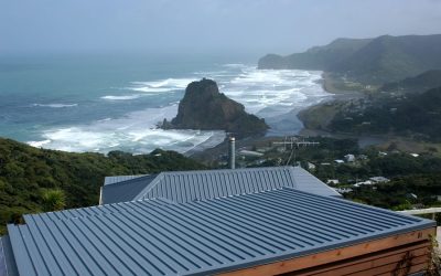
For it to remain as Category 1a recognises its heritage, ecological, wilderness and recreational values, and its national significance under the Waitakere Ranges Heritage Area Act, passed into law by Parliament in 2008.
WRPS has a concern around how to manage the influx of visitors in coming years sustainably, and that tourists are being funnelled through particular areas. The provision of some form of public transport service would negate the need to develop car parks, as well as play a role in directing visitors more easily to sites better able to cope with large numbers and therefore protecting more sensitive locations.
The review of the RPMP should revisit the direction of works to protect kauri in the park. The track upgrading should be embedded in a policy context that seeks to protect the values of the park, the natural features within it and the visitor experience. Any proposals to close tracks permanently should be reviewed as part of this RPMP review. The heritage and history of individual tracks should be part of such a review. As the largest regional park (17,000 ha), the oldest regional park, the foundational park of the regional parks’ network, and as it is close to the most populated part of the Auckland region, the Waitākere Ranges
parkland deserves special attention and faces particular challenges from kauri dieback and over-use. The Waitākere Ranges being a place of natural heritage should remain as a core value in the RPMP. It is an invaluable place of biodiversity and must be protected and maintained.

Driving on Muriwai Beach (May, 2021)
WRPS feels strongly that Muriwai Beach should be closed to recreational vehicle use. This view is due to environmental concerns of the area which are hugely impacted by vehicle use; the toheroa population hasn’t recovered, and the sand dunes ecosystems in the area are ranked as endangered. There are 12 threatened and at-risk species within the Muriwai Regional Park, including the rare Muriwai gecko and the white-fronted tern. The increased fire risk indicated and the safety concerns for children, horse riders, and the drivers of vehicles themselves are also serious concerns which must be prioritised.

Climate Change Commission draft advice to govt (March, 2021)
The Climate Change Commission’s draft advice – He Pou a Rangi – is a comprehensive, optimistic and ambitious new plan. We agree that current Government policies do not put Aotearoa on the right track to reach 2050 targets, and there is a need for change. We acknowledge and commend the focus on decarbonisation of industries, rather than increasing reliance on (plantation) forestry. The general recommendations and proposals of the CCC’s advice are supported.
However there is not enough emphasis on the importance of permanent native forests, or the mitigation of drought and fire risks. WRPS feels strongly about the need to include public transport in areas such as the WRHA to reduce the negative impacts of increasing numbers of vehicles visiting and we would also like to see increased funding for caring for our native forestry, including more research into pest pathogens such as Kauri dieback, pest animal control for pigs, deer, goats possums, and an increase in urban tree planting.

Auckland Council 10-year Recovery Budget (March, 2021),
WRPS supports the key outcome areas for responding to climate change: Coastal investment and developing coastal management plans to respond to coastal erosion; Increasing permanent native forests; Increasing the numbers of street trees in urban areas, especially native trees; Address the issues of toxic burden from closed landfills (however it is inadequate to only protect 4 of the council’s 85 closed coastal landfills). WRPS supports the extension as well as an increase in the Natural Environment Targeted Rate and Water Quality Targeted Rate. We feel it is needed to have specific plans to clean up important West coast areas such as lagoons and that appropriate management includes the serious involvement of Tangata Whenua. WRPS calls for increased funding and continued active management of pest and threatened species to be able to maintain and increase our native forests.

Huia Water Treatment Plant
In June 2021 Watercare’s application to clear 3.5 hectares of pristine bush in the Waima located in the Waitakere Ranges Heritage Area was granted. Of the submissions made in response to the 2019 application 468 were against, 20 were in support, and 8 were neutral.
WRPS was extremely concerned and had submitted extensively in opposition to this application being granted. Concerns included: that this application will generate significant and unwarranted adverse effects on the environment, will be contrary to the sustainable management of natural and physical resources, is inconsistent with the purposes and principles in Part 2 of the Resource Management Act 1991.
The application will have significant adverse effects on extensive areas of high quality and ecologically valuable native bush, birdlife and other flora and fauna. WRPS is concerned that the mitigation proposed will not adequately address the adverse effects that will be generated by the proposal.
There were subsequent appeals to the consent of the application showing the proposal could be breaching the Biosecurity Acet, as well as breaching the Waitakere Ranges rahui, Te Kawerau a Maki’s tikanga, as well as damaging the mauri of the environment downstream of the works.
Te Henga Quarry
Currently the Te Henga quarry park (or Waitipu-Waitākere Quarry Park ) is closed. In April-May this year (2022) there was feedback requested on how to go about restoring the land and reopening the site as a local park for public use.
WRPS strongly supports developing the water catchment area within the quarry park as a wetland for the following reasons:
- There are two semi-connected wetlands within the Waitipu-Waitākere Quarry Park at the head of Te Henga valley. A short section of Waitipu Stream flows through them.
- Te Henga is one of the most significant natural wetlands in Tāmaki Makaurau, supporting further health and extension of it makes absolute sense, and the restoration of the Waitipu-Waitākere Quarry Park/Te Henga Quarry Park is an opportunity to do that.
- More wetland area would provide a valuable function in filtering out sediment from the stream as it flows downstream to Waitākere River, Te Henga wetland, and onto Te Henga beach.
- The wetlands are dominated by raupō. The two pools within the quarry have varying amounts of raupō-dominated wetland vegetation on the edges.
- Raupō has a regional IUCN threat status of endangered.
- Raupō reedlands and wetland habitat supports a diverse range of native birds including: pāteke (brown teal), mātātā (fernbird), Koitareke (marsh crake), pūweto (spotless crake), moiweka (banded rail), kāhu (harrier), matuku-hūrepo (Australasian bittern).
- Matuku-hūrepo are under threat of extinction due to the extensive loss of their wetland habitat and ongoing pressures such as predation. Their national population has sharply declined. This species is now ranked as Nationally Critical (the same threat level as kākāpō).
- WRPS strongly supports considering the Waitākere Stream catchment as a whole. This principle supports wetland development.
- WRPS strongly supports ongoing weed and pest control and monitoring.

Ark in the Park
Located within the Waitakere Ranges Regional Park, The Ark is a collaborative project between Forest & Bird and Auckland Council, supported by local mana whenua Te Kawerau ā Maki.
With 400 volunteers it protects/caretakes for 2270 hectares monitoring wildlife, engaging in predator control and research, and has to date set 554 traps and manages 4785 bait stations.
The concept for Ark in the Park started with a member of Forest and Bird’s Waitākere Branch in early 1999.
The Waitākere Ranges Protection Society was invited to be involved and a steering committee was set up in May of 1999. This aimed to further the concept of an “open sanctuary” where, with increased predator control and targeted weed control, the ecology of the Waitākere Ranges would be restored and species that had been lost would be reintroduced to the ecosystem. The concept of the “Ark in the Park” within regional parkland was developed, in collaboration with the former Auckland Regional Council and others.
The Ark in the Park aim is to restore functioning native ecosystems through pest control and reintroduction of native animals and plants lost from the Waitākere Ranges. Auckland Council’s possum control has allowed the forest vegetation to recover, but restoration of many of the “lost” species cannot happen unless we bring them back, and protect them with ongoing intensive pest control (especially for rats and mustelids). So far toutouwai/robin and kōkako have been successfully returned.
Unlike many other “mainland island” projects, Ark in the Park does not have a predator proof fence – instead, ongoing pest control by our volunteers and neighbours keeps predator numbers low enough to allow survival and breeding of re-introduced as well as original native birds and other biodiversity
Having no boundary fence has allowed the expansion of predator control work without barriers, and follow native wildlife populations as they establish territories in newly protected habitats.
Predator control within the Ark must be continuous and ongoing. Introduced predators are kept to low levels with a grid of bait stations, a network of traps and ongoing vigilance.
This ongoing work allows existing populations of native wildlife such as plants, fungi, insects, frogs, bats and birds to recover. It also means we can safely return species that were once present in the Waitākere Ranges through our translocation programme. So far, toutouwai/North Island robins have been successfully reintroduced, and there is a growing population of North Island kōkako

Kauri Dieback 2021 Survey report summary
2021 Waitakere Ranges Kauri Population Health Monitoring Survey
This is the third survey carried out by Auckland Council on the Waitakere Ranges Regional Park for kauri dieback disease.
Remote sensing was used to detect kauri trees >15m tall within the forest canopy of Te Wao Nui Tiriwa/ the Waitakere Ranges parkland. . It is unknown how many kauri shorter than 15 m are within the Waitakere Ranges as they were not easily detectable with remote sensing technologies available in 2020/21. The research surveyed a representative sample of 2140 trees, out of 68,420 identified within the forest. The soil beneath 761 of these trees were tested for P. agathidicida presence.
The baseline pathogen prevalence of P. agathidicida detection was 76/761 (10%) in soil samples, and kauri dieback symptoms in 16.5% of surveyed trees. The spatial distribution of P. agathidicida from the 761 soil sampled trees showed a greater density of P. agathidicida detections in the northern, central-western and southern borders of the study area. There was no detection of P. agathidicida in the central interior areas of the Park.
An interesting finding was that kauri seedlings and saplings were surviving in soils where P. agathidicida was confirmed. This study provides a consistent cohort of monitored trees that can be remeasured to understand change in disease and pathogen prevalence over time.
The results supported the precautionary approach taken since 2018 and continued measures to stop the spread of Phytophthora agathidicida.
Local Government News
Huia Water Treatment Plant
Watercare is considering the options to replace the Huia Water Treatment Plant, which at nearly 100 years old is reaching the end of its life. The Waitakere Ranges dams provide around 20% of Auckland’s water, so it the treatment plant is a critical piece of infrastructure for Auckland.
Over the summer, the Watercare project team has been investigating potential sites in the area that could be used for the new plant. This has included using Geographical Information Systems (GIS) to identify sites that meet the key criteria of size, elevation that enables gravity feeding, proximity to existing infrastructure (e.g. pipelines), land slope and are outside dam catchments.
From this mapping exercise, Watercare have identified a long-list of possible locations and done an initial visit to check for fatal flaws (e.g. complete forest cover, poor access). They are now doing an initial technical assessment of the long-list to identify 3–4 sites to include in a short-list of possible locations.
The Society is on a stakeholder group that is meeting regularly for updates and providing feedback as the project progresses. Look out for updates on our webpage and in newsletters on how this is progressing.
Watercare will also undertake community consultation once it has identified a short-list and preferred site.
Te Henga Quarry Restoration
The Te Henga Quarry is due to close in March 2015 and re vegetation of the site will be undertaken by the quarry operator. Auckland Council Properties Ltd is Auckland Council’s delegated representative for the quarry site and is consulting with the Waitakere Ranges Local Board over a proposal to restore the quarry. As reported in the Western Leader (16 October 2014) David Rankin, Auckland Council Property Ltd chief executive said “The board is best placed to determine the nature of the work to be undertaken…”. For more details read the Te Henga Quarry Restoration.
Waitākere Ranges Local Board
The Waitākere Ranges Local Board is focused on a The Waitakere Ranges Local Board reports number of areas based on delivering tangible improvements for our communities.
The Waitakere Local Board’s Agreement sets out the budget and funding for activities and performance measures for the financial year and puts the local board’s vision into action. Local board agreements are part of the council’s annual plan. The Waitākere Local Board agreement for 2014/2015 is a part of the draft annual plan, which is currently open for consultation.
What’s the plan for Waitākere Ranges?
Following the first round of community consultation received in February and March, the Board is now reviewing feedback and writing the draft local board plan. Local board plans are guiding documents for local boards.
The plans, which are strategic three-year plans for each local board, reflect the priorities and preferences of the community.
This will be open for formal submissions from 7 July to 6 August 2014.
Feedback was requested on:
• working with our communities to protect the Waitākere Ranges Heritage Area
• protecting and restoring the unique natural environments of our area, its forests and coasts
• fostering arts and culture, including developing Titirangi as the vibrant arts hub for the west
• supporting sustainable local economic activity, including enabling home-based occupations in the ranges
• revitalising our urban villages and town centres as attractive places to live and do business, connected by green walkways and cycleways
• supporting reliable and frequent public transport with connection to the electrified rail network.
The final plan will be adopted by 31 October 2014. If you have any queries about the local board plan, you can contact the Waitākere Ranges Local Board. or contact the local board office on 09 813 9150![]() 09 813 9150.
09 813 9150.
Business stock take
The Waitakere Ranges Local Board has recently overseen a business stock take. It was carried out in May-July 2014 to assess the scope and potential for sustainable economic development within the WRHA.
Foothills walkway
The Waitakere Ranges Local Board is continuing planning for the proposed ‘foothills walkway”. The walkway will eventually traverse the length of the Waitakere Ranges Foothills from the Swanson Railway Station in the north to the Arataki Visitor Centre and Titirangi in the south. Work is currently being done to capture all the information required to apply for the resource consents for the walkway, and to lodge the application.
Piha Dune Management Plan
The Waitakere Ranges Local Board reports that Coastal specialist Jim Dahm has developed an operational management plan for Piha Beach from the southern side of Lion Rock to the southern end of Marine Parade South.
The plan considered the following:
coastal processes and shoreline trends
review of dune management to date
proposed dune management plan.
This plan was presented to the previous Waitākere Ranges Local Board for adoption at their 9 October 2013 meeting, but the board requested further time be allowed for the community to provide feedback. The consultation closed at the end of April 2014 and the Waitākere Ranges Local Board is now considering all of the feedback that was submitted.
View the plan: Dune Management at Piha: review and proposed management plan – October 2013.
Hard copies of the plan are available at the Piha Community Library.

The environmental health of the Waitākere Ranges
The environmental health of the Waitākere Ranges is an important focus for Waitākere Ranges Local Board.
Protecting and restoring the area’s unique natural environments will be a key priority of the new local board plan, with ecological weed control, animal pests and education around kauri dieback disease high on the agenda.
Auckland Council parks staff have worked with the local board to identify initial high-profile weed-control and restoration sites around the area.
Weeds targeted will include pampas grass, woolly nightshade, climbing asparagus, wild ginger and large stands of the giant reed, arundo grass.
“In the last council term, the local board delivered the first monitoring report required under the Waitākere Ranges Heritage Area Act,” says Waitākere Ranges Local Board Member Saffron Toms, who holds the local board’s environment portfolio.
“We now want to implement the report’s recommendations, with significant focus on increased environmental protection,” she says.
Temporary signage will be erected at the sites to explain the work being carried out, and information highlighting the worst weeds in the heritage area will also be distributed to households.
Did you know?
The Waitākere Ranges Local Board area contains 40 per cent of Auckland’s native vegetation. Over 80 per cent of the local board area is covered in native vegetation.
(Information from the Auckland Council website)
Foothills walkway
The Waitakere Ranges Local Board is continuing planning for the proposed ‘foothills walkway”. The walkway will eventually traverse the length of the Waitakere Ranges Foothills from the Swanson Railway Station in the north to the Arataki Visitor Centre and Titirangi in the south. Work is currently being done to capture all the information required to apply for the resource consents for the walkway, and to lodge the application.
Auckland Regional Bat survey
An Auckland Regional Bat survey completed this year found bat activity in Te Henga (Matuku, & Lake Wainamu and Kawaupaka) but the Kokako Management Area and buffer in Ark in the Park area of the Waitakere Ranges Regional Parkland detected 910 bat passes over 10 nights – the highest rate ever recorded by Council. The Waitakeres are a bat hotspot, with advantages from pest control not just for birds and plants, but evidently for bats as well!
Forest and Bird’s Green Ribbon
Forest and Bird’s and Auckland Council’s Waitakere Ranges partnership project ‘Ark in the Park’, last month won a Green Ribbon award in the Stewardship Champions category. In the project based around the Cascades Kauri area in the Ranges Parkland, harnesses over 600 volunteers who contribute more than 9000 volunteer hours every year. The success of the project is obvious. With the reduction of animal pests and the reintroduction of whiteheads, robins, kokako and more to come, the forest resounds with birdsong.
A place of great significance to residents, tangata whenua, Aucklanders and visitors alike.
The Act recognises the importance of the Waitakere Ranges Regional Park which covers some 17,000ha, or around 60 per cent of the heritage area, as an accessible public place with significant natural, historical, cultural and recreational resources.
The Act responds to concerns about the effects that development is having, or could have, on the landscapes and heritage of the Waitakere Ranges. It recognises the national, regional and local significance of the Waitakere Ranges and promotes its long-term protection and enhancement for present and future generations.
The Act also recognises that people live and work within this area (over 21,000 residents in 2005), and that many have contributed to shaping the landscapes that we see today and have helped protect its natural environment and human heritage. It seeks to set a benchmark for Waitakere Ranges’ residents goals and hopes for their communities and environment in 10, 50 and 100 years time. It aims to protect and enhance the area’s significant heritage features and the special character of each community in the ranges, and to provide a rural transition from the city’s urban areas to bush and coastal areas further west in the ranges.
View and print a high resolution map of the Waitakere Ranges Heritage Area .
The Waitākere Ranges Foothills Design Guide
The Waitakere Ranges Local Board recently reviewed and signed off on a revised version of the Waitākere Ranges Foothills Design Guide. Information about the WRHAA will now be included on LIM reports which will also include a reference to the (reviewed) design guide. This will help those seeking to build or develop in the Waitākere Ranges Heritage Area.
The design guide is non-statutory and was first produced under the former Waitākere City Council. But board members agreed with a finding of the first Heritage Area Monitoring Report last year that said more needed to be done to promote awareness and use of the guide by landowners and council officers.
It funded the updating and reprinting of the document and has agreed it should be referred to in all Land Information Memorandums issued for sites in the Heritage Area.
For copies or more information on the design guide, contact nicholas.lau@aucklandcouncil.govt.nz
For more information from the Waitakere Ranges Local Board see their Newsletter August 2014.

First community consultation event for the Bethell’s Beach/Te Henga and Waitakere River Valley Local Area Plan
The first community consultation event for the Local Area Plan (LAP) for Bethell’s Beach/Te Henga and Waitakere River Valley was held on Wednesday 4th June, 6.30-9.00pm, at the Waitakere Primary School Hall.
This LAP is prepared under the Waitakere Ranges Heritage Area Act 2008, whose purpose is to protect and enhance the heritage features of the Heritage Area. Please see the Auckland Council LAP newsletter for more details.
This event was an opportunity to celebrate this wonderful place and its people with talks by local iwi Te Kawerau a Maki, John Edgar from Waitakere Ranges Protection Society, local historian Mary Woodward and John Sumich from Ark in the Park and Habitat Te Henga.
Following the talks, there were thematic group discussions to start building relationships amongst residents, community organisations and council staff, form working groups around different topics, bring together the information that’s available to council, iwi and community on the area, and plan the work ahead.
Weed-free buffer project
The Local Board have carried out a new ‘Weed free buffer project’ focused on Bush Rd and Opunuku Valley. These areas were chosen because of the levels of weed infestation, interest, and conservation benefits. 72 properties were visited and provided with information packs, with 70% keen on further engagement. 15 properties were helped with weed management plans, 32 properties were provided with materials, 22 were provided contractor assistance. The result was targeted assistance with weed control, better awareness about regional park boundaries and improved biodiversity and habitat management.
Waitakere Ranges Visitor Management
Auckland Council have been working on a visitor management plan for the Waitakere Ranges Heritage Area.
In May 2013 they released the final version of document the Waitakere Ranges Visitor Management Plan Background Report.
Plan Changes
Proposed Plan Changes 35, 36 and 37: These plan changes were publicly notified by the former Waitakere City Council on 10 February 2010. They are considered necessary to achieve the purpose of the Resource Management Act 1991 (RMA) and the Waitakere Ranges Heritage Area Act 2008.
Proposed Plan Change 35 proposes to establish a new Policy Section 5B, entitled Waitakere Ranges Heritage Area. It also incorporates those elements of the Oratia and Waiatarua Local Area Plans that relate to the RMA into the District Plan.
Proposed Plan Change 36 proposes to improve regulatory provisions within the Waitakere Ranges Heritage Area associated with rural activities, the enabling of future uses of rural land to retain a rural character, and to provide for the social, cultural and economic wellbeing of the people and communities in the Waitakere Ranges Heritage Area. It amends rules for the Foothills, Coastal Village, Bush Living and Waitakere Ranges Environments. Plan change No 36 became operative on Monday 21 October 2013.
Proposed Plan Change 37 removes inappropriate District Plan provisions relating to Titirangi Village, and proposes new policy guidance and matters of assessment that seeks to provide long-term certainty for the desired future character and amenity of Titirangi Village.
Auckland Transport and design guide for urbanising effect of infrastructure
Auckland Transport have held a workshop to start developing a code of conduct/road corridor design & management guidelines to address the ‘urbanising effect’ of infrastructure. They plan to develop a design guide for the Heritage Area. This should help avoid adverse impacts from built infrastructure such as too many road signs or streetlights. See here for more information.
Heritage Area Newsletters
A Community Information Pack on the Waitakere Ranges Heritage Area is now available.
This pack contains information on a range of issues relevant to the Heritage Area including its history, culture and biodiversity, the Regional Park, information on protecting and restoring the ecology of the area, and information on community links and resources.
The pack is an initiative of the West Coast Plan Liaison Group, the Waitakere City Council and the Auckland Regional Council. Packs are available to all residents of the Heritage Area.
You can download any of the pack contents from www.waitakere.govt.nz
Heritage Area Newsletters
Newsletter 1
Newsletter 2
Local Area Plans
A Local Area Plan (LAP) is a planning mechanism provided for under Section 25 of the Waitakere Ranges Heritage Area Act 2008 and must be developed together with local communities.
The Act acknowledges that within the ranges and foothills there are diverse places and communities, each with a distinctive character and future. LAPs must identify the boundary of the local area and will set goals for retaining and enhancing the heritage features and character of each of these distinctive areas and providing for the wellbeing of the community.
LAPs and associated background reports have been completed for Waiatarua, Oratia, and Henderson Valley/Opanuku. A Foothills Background Report covering the whole of the eastern foothills area and providing context for the Foothills LAPs, has also been prepared. In addition, a background report has been prepared for the Bethells/Te Henga/Waitakere Valley area, in anticipation of a Local Area Plan for that area. In the future, LAPs will also be developed for the remaining foothills settlements (Anzac Valley and Swanson), and coastal settlements along the Tasman Sea and Manukau Harbour coasts.
Heritage Area Act News